RMUS Bridge Inspection Solution

Powered by Skydio & Qii.AI

RMUS Bridge Inspection Solution

Powered by Skydio & Qii.AI

Product Description

Bridge and other complex infrastructure inspection is a task that has challenged both RMUS and the entire Unmanned Systems industry. After years of trial and error, we feel that we have found the ideal combination of hardware and software to execute complex infrastructure inspection and reporting, the RMUS Bridge Inspection Solution powered by Skydio & Qii.AI.


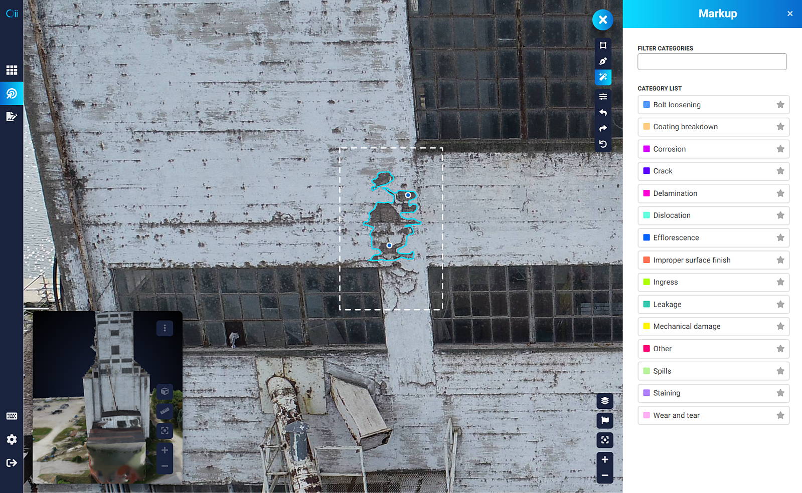
The package combines Skydio’s adaptive scanning software, Skydio 3D Scan™, with Qii.AI’s computer-assisted detection and quantification software, to empower your pilots to gather and report actionable data as easily and efficiently as possible. The RMUS Bridge Inspection Solution includes the following hardware and software items:

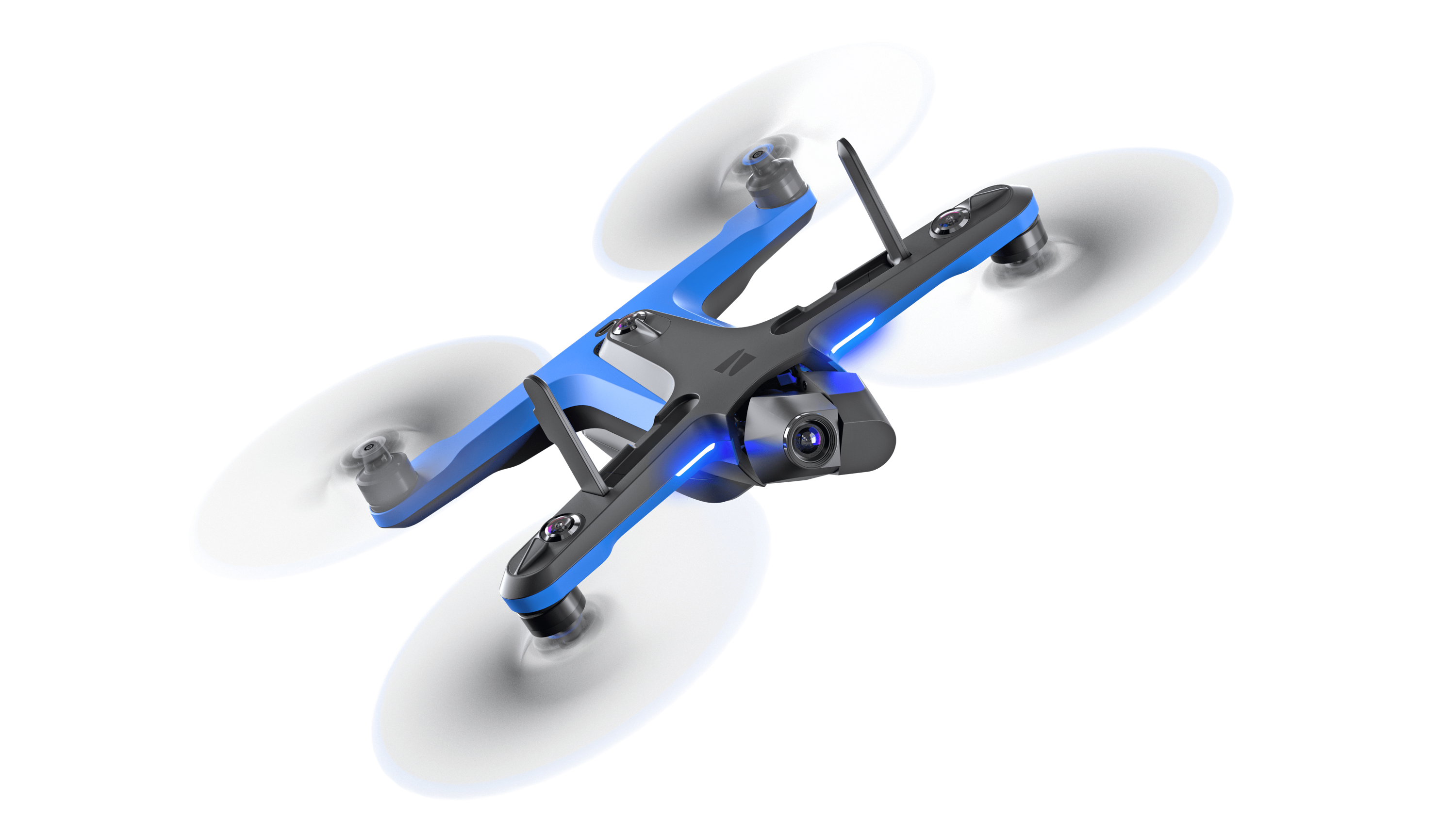
- Skydio 2+ Enterprise with Controller Kit [includes one (1) Skydio 2+ vehicle, three (3) batteries, one (1) wall adapter, one (1) USB type C cable, one (1) microfiber cloth, one (1) Beacon, one (1) Skydio Enterprise Controller, one (1) admin case, one (1) set of ND Filters, one (1) dual battery charger, two (2) 256GB SD cards (pre-installed), four (4) CW propeller blades, four (4) CCW propeller blades]

- Three (3) Skydio 2+ Batteries

- Skydio 2+ Dual Charger

- Skydio 2+ Spare Propeller Set (2 clockwise, 2 counterclockwise)

- Skydio 2 Foot Landing Pad

- Skydio Autonomy Enterprise software for 2+ (3 Years)

- Skydio 3D Scan for S2+ (3 years)

- Skydio 2+ Enterprise Care plan

- Skydio Academy Online (3 year access)

- Qii.ai Software (1 year) Includes 100 Processed Giga Pixel per user


How It Works


First, the pilot executes a flight using Skydio’s 2+ aircraft and its adaptive scanning software, Skydio 3D Scan™, for fully autonomous photographic data collection and mapping of the asset.


Next, the data is ported into Qii.AI’s computer-assisted detection and quantification software to identify and log defects such as corrosion and cracks. This integration between the Skydio and Qii.AI software makes inspection of large, complex structures significantly more efficient, while reducing the time required by inspectors to identify and classify defects.


Skydio 2+ at a glance

Max Flight Time

27 min

Max Speed

36 mph


Weight (with battery)

800 g

Product Specs

General

Size with battery (antennas up):

229 x 274 x 126 mm (l x w x h)

Size with battery (antennas down):

229 x 274 x 76 mm (l x w x h)

Size without battery (antennas up):

229 x 274 x 101 mm (l x w x h)

Size without battery (antennas down):

229 x 274 x 51 mm (l x w x h)

Size Of Included Hard Case:

297 x 255 x 65 mm (l x w x h) (case fits: drone, spare propellers, charging cable, and either 2 batteries or 1 battery and 1 wall adapter.)

Weight (With Battery):

800 g

Flight Time:

27 minutes

Max Flight Speed (Sea Level, No Wind):

36 mph (fully autonomous)

Max Wind Speed Resistance:

25 mph

Max Service Ceiling (Above Sea Level):

15,000 ft density altitude

Max Flight Altitude (From Control Device):

1,640 ft

Operational Temperature Range:

-5°C to 40°C

Primary Camera System

Sensor Type:

Sony IMX577 1/2.3” 12.3MP CMOS

Sensor Active Pixels:

4056 (H) x 3040 (V)

Lens Aperture:

f/2.8

Lens Focal Length:

20mm (35mm format equivalent)

Lens Depth Of Field:

1m - ∞

Shutter Speed:

Electronic shutter 1 to 1/1920s

Iso Range:

video 100-3200 photo 100-3200

Exposure Control:

-2.0, -1.5, -1.0, -0.5, 0, 0.5, 1.0, 1.5, 2.0

Image Signal Processor:

Qualcomm QCS605

GPU:

Adreno™ 615

CPU:

64-bit octa-core Kryo™ 300

DSP:

Hexagon™ 685, 2x HVX

Resolution And Modes:

3840x2160 30 fps 

3840x2160 60 fps 

3840x2160 48 fps 

3840x2160 24 fps 

1920x1080 120 fps 

1920x1080 60 fps 

1920x1080 30 fps

Bitrate:

100 Mbps

Video Format:

MPEG-4 (AVC/H.264, HEVC/H.265)

Still Resolution:

4056x3040 (12 MP)

Still Formats:

JPEG, DNG (RAW)

Still Modes:

Single, Interval

Dynamic Range:

13 stops

Storage:

Removable Micro SD Card UHS Speed Class 3 / V30

Stabilization Mechanical Range:

pitch ±124°, roll ±120°, yaw ±12.5°

Pitch Controllable Range:

-90° to 45°

Autonomy System

MAIN PROCESSOR:

NVIDIA Tegra X2 SOC

CAMERA CONFIGURATION:

6x cameras in trinocular configuration top and bottom 

ENVIRONMENT COVERAGE:

True 360°

OBSTACLE AVOIDANCE COVERAGE:

Omnidirectional

3D WORLD MODEL UPDATE RATE:

> 1 million points per second

WORLD MODEL-TO-ACTION UPDATE RATE:

500 iterations per second

ONBOARD AI:

9 custom deep networks used in flight

USER-SELECTABLE SUBJECTS FOR TRACKING:

People and motor vehicles

OBJECT TRACKING AND IDENTIFICATION:

Up to 20 simultaneous objects of interest

CALIBRATION:

Automated calibration of lens parameters, cameras, wind speed, and air density

ADVANCED AI-PILOT ASSISTANCE:

360 Superzoom, Close Proximity,

Obstacle Avoidance, Point-of-Interest

Orbit, Track-in-Place, Vertical View,

Visual Return-to-Hom

Navigation Camera System

Configuration:

6x cameras in trinocular configuration top and bottom

Sensor Type:

Sony 1/3” 4K color CMOS

Lens Aperture:

f/1.8

Field-Of-View:

200°

Environment Coverage:

True 360°

Wireless and GPS

Range To Phone (Line Of Sight, Ideal Conditions):

200 m

Range To Beacon (Line Of Sight, Ideal Conditions):

3 km*

Range To Controller (Line Of Sight, Ideal Conditions):

6 km*

Operating Frequencies:

5.18-5.24 GHz 5.725-5.85 GHz

Channel Width (Standard Wifi):

20 and 40 MHz

Channel Width (Skydio Link™):

5 and 10 MHz

Controller

Size Folded:

94 x 153 x 71 mm (l x w x h)

Size Unfolded:

153 x 153 x 117 mm (l x w x h)

Weight:

386 grams

Operational Temperature Range:

-5°C to 40°C

Live Streaming Resolution:

HD 720p

iOS And Android Supported Mobile Devices:

iOS and Android screen size up to 6" and tablets with optional adapter

Battery Life:

2h30 (Android) 5h30 (iOS)

Battery Capacity:

2500mAh 3.6V

USB Ports:

USB-C (Charge and Data)

Design And Manufacturing:

Parrot SA

Range (Line Of Sight, Ideal Conditions):

6 km

Operating Frequencies:

2.4-2.483 GHz 5.18-5.24 GHz 5.725-5.85 GHz

Channel Width (Standard Wifi);

20, 40, and 80 MHz

Channel Width (Skydio Link™):

5 and 10 MHz

Gps Satellite Constellations:

GPS and GLONASS


RMUS 360 Solution

Certified Technicians

RMUS employs a team of certified technicians that oversee each Skydio 2+ system. They perform a highly detailed inspection, calibration and testing process on each Skydio 2+.

Ready-to-Deploy Package

RMUS leverages our experience in multiple industries to create “Ready-to-Deploy” packages that include all the necessary hardware, software, and auxiliary items for successful field operations.


Skydio 2+ Training Package

The Skydio Academy offers two (2) types of certifications, including Skydio Professional Operator (SPO) and Skydio Expert Operator (SEO). There are also several training method options available, including online, virtual instructors, and in-person hands-on training sessions, so you can choose the training program that works for you. Speak to your RMUS Sales Rep for more information and pricing for the Skydio Academy. 

We offer the best prices and will price match. We offer significant discounts to law enforcement agencies, emergency service organizations, government entities, educational institutions and other qualified organizations.


RMUS Bridge Inspection Solution 

powered by Skydio & Qii.AI

Name:

Phone:

Email:

Company/Agency Name:

Product of Interest:

Message:

RMUS Bridge Inspection Solution

Brochure Download


Name:

Email:

Company/Agency Name: